Usage with Garmin Mapsource II
Finally I found out how to make Mapsource draw the contour lines over instead of below the forests and lakes. In the GPS device there is the "Draw Priority" to control this. Mapsource on the other hand seems not to care about this. It simply draws the map tiles in the order of their numbering.
Until October the contour tiles were numbered 21000001 - 22000023 and the OSM layer tiles started at 30000001, so everything looked wrong. The November update has a new numbering scheme: OSM tiles start at 10000001.
This is how the import works:
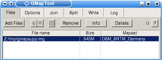
1.) First open the file gmapsupp.img in GMapTool with [Files] [Add Files]: (click on the images to enlarge)
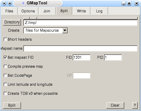
2.) Use [Split] to split the map into the single files. Use the settings shown in the image. The destination directory can be chosen freely:
3.) Now you can compile the overview map with mkgmap out of mapset00.mp or simply download this mapset00.img and copy it into the destination directory.
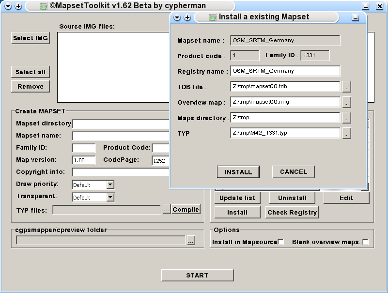
4.) Now you can import the map into mapsource using MapSetToolKit. Click on [Install a existing mapset]. First choose the TDB file with [...], move through the directories, select the TDB file, [Open]. MapSetToolKit fills the grey fields itself. You can enter anything for "Registry Name". Use the directories according to your own computer. The files mapset00.tdb and M42_1331.typ were made in step 1. The "Maps Directory" is the destination directory from above:
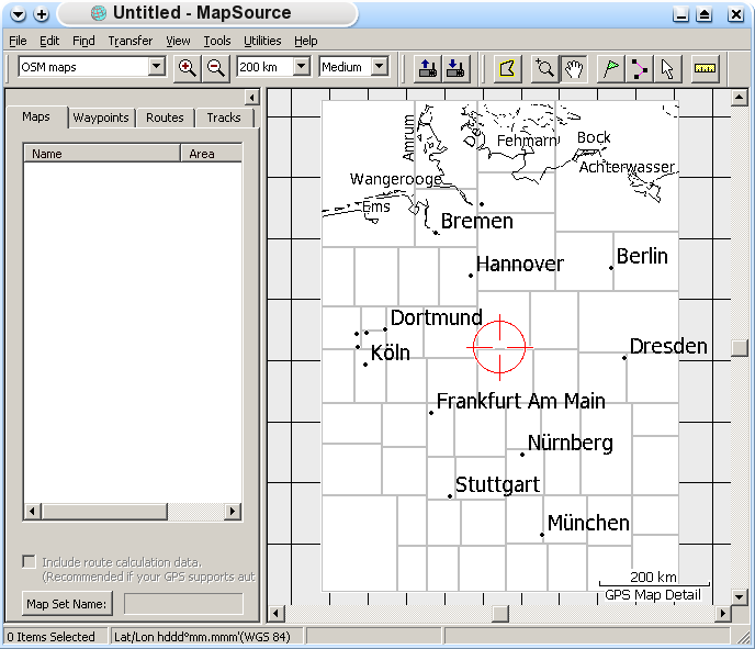
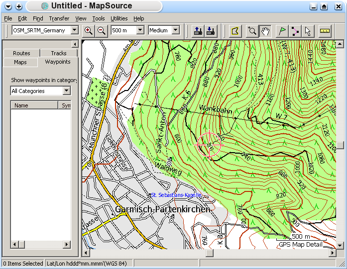
5.) Done. Start Mapsource, and the map can be used from the menu:
and here are the contour lines, too:
6.) If you have imported an older version of my map before and only want to get an update into Mapsource which has the same "Mapset Name" you only have to do the steps 1.) to 3.) and overwrite the old map tile files, TDB file and overview map.
2 comments
Hallo Ralf,
die Topo-Karten funktionieren einwandfrei auf meinem GPSmap 76Cx. Auch das Einbinden in Mapsource lief auf Anhieb. Allerdings habe ich ein Problem beim Austausch der Daten gegen die Kacheln vom November. Hier die Fehlermeldung von GMaptool:
Rest gesnippt:
Write map 22000023 -> 22000023.img, file 3524608, header 2800h, block 2048
Write data M42_1331 -> M42_1331.typ, len. 3585
Write data 0M1_2512 -> 0M1_2512.typ, len. 187
Write data 0M1_2513 -> 0M1_2513.typ, len. 187
== Warning: Multiple products in img.
Write file mapset.mp
Write file mapset.tdb
Write file mapset.mdx
There were warnings, result can be faulty.
End.
Ich habe versuchsweise die gesplitteten Kacheln wie beschrieben Mapsource “untergejubelt", aber ich habe nur stellenweise Höhenlinien, teilweise sind nur die Höhenangaben sichtbar.
Irgend eine Idee was ich falsch mache?
Vielen Dank nochmal für Karten und Tips!
Rainer aus Adelberg
@Rainer Schmitz:
Ich habe auch schon manchmal beobachtet, daß Mapsource die Höhenlinien nicht immer korrekt zeichnet. Meist wenn man im Mapsource zoomt und die Karte oft verschiebt. Es hilft i.a. wenn ich ganz herauszoome, Mapsource beende und neu starte.
Die Warnung vom Mapsource ist belanglos. Die bedeutet nur, daß man die erzeugte TDB-Datei nicht verwenden kann weil verschiedene Families in dem IMG waren. Deshalb für Mapsource immer die TDB von meiner Homepage verwenden!